
My Journey in Youth-Led GIS Technology for Climate Change Adaptation with G-SIG
My Journey in
Youth-Led GIS Technology for Climate Change Adaptation Through Participatory Mapping and Waste Management in Timor-Leste
Hi readers, my name is Abilio da Costa, a university student from Instituto Profissional de Canossa (IPDC), where I focus on technology and information studies. I am pleased to share my journey in the Youth-Led GIS Technology Program for Climate Change Adaptation, with a focus on waste mapping using GIS tools such as Ushahidi.
Explore more about our Mapping Initiatives here:
Discovering Ushahidi?
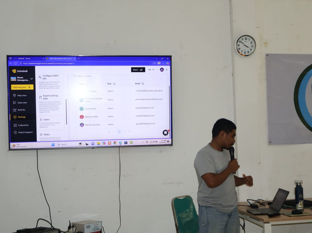
When I first learned about the Ushahidi application through G-SIG during the introductory training, I immediately recognized it as a powerful platform worth exploring. What makes Ushahidi unique is its ability to report real-world problems, monitor waste issues, and collect accurate, field-based data. After the training, I took the initiative to explore more about Ushahidi online. I found it to be an inspiring and practical tool. One of the things I appreciate most is that it is free, open-source, and easy to understand and use. Another key advantage is the ability to collect real-time data and instantly visualize it on an interactive map.
Learning Through Practice?
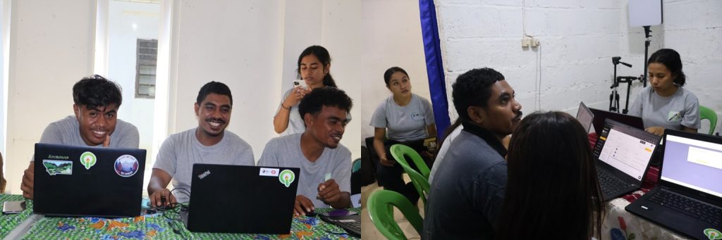
Throughout this journey, I gained valuable hands-on experience in digital mapping. I learned how to Create mapping projects, Design data collection forms, collect field data using mobile applications, Validate and review data before visualization to Ensure data quality for better decision-making. These experiences helped me understand how important it is to manage and verify data properly to ensure reliable results in the future.
Skills I Have Developed?
This program has strengthened my knowledge and skills in Geographic Information Systems (GIS), climate change issues, and environmental challenges, especially waste management in the city of Dili. I am now confident in using Ushahidi to create projects, collect and report data, and manage data quality through the platform’s dashboard. In addition, I have developed strong skills in participatory digital mapping, including data interpretation and analysis. This experience has also allowed me to build meaningful connections with other young people, exchange ideas, and create strong friendships for the future.
My Favorite Part of Using GIS?
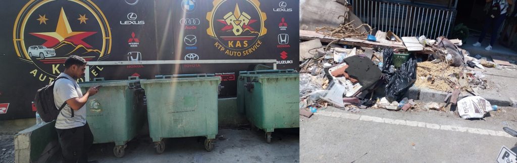
My favorite moment when using GIS and Ushahidi is when data collected from the field appears live on the map. It is a powerful experience to see reports such as illegal dumping sites, areas without waste management, and communities affected by poor waste practices visualized in real time. I also really enjoy the field data collection process using mobile phones, especially when working together with other young people. This creates a strong sense of ownership and teamwork, as everyone can see how their contributions support real decision-making and problem-solving in the community.
How GIS Supports Better Decision-Making?
Technologies like GIS and Ushahidi play an important role in solving environmental problems in Timor-Leste by improving how we collect, share, and respond to information. They enable real-time reporting of issues such as illegal dumping, flooding, landslides, and coastal erosion, which helps authorities and organizations respond more quickly. They also support community participation by allowing local people to raise problems directly instead of waiting for formal assessments. Furthermore, they support evidence-based decision-making, as all data is mapped and organized, making it easier to identify high-risk areas and plan effective interventions.
By combining local knowledge with technology, we can build a more resilient and sustainable Timor-Leste.
Key Takeaway?
GIS and digital mapping are not only for experts; it is something that all of us can learn and use to create positive change in our communities. Through tools like Ushahidi, Google Maps, and OpenStreetMap, young people can actively contribute to solving environmental and disaster-related challenges. Even simple data collection using a mobile phone can make a big difference. By combining local knowledge with technology, we can build a more resilient, informed, and sustainable Timor-Leste for the future.


