News

G-SIG Spotlight: Advancing Drone Mapping with Remote Sensing Practice
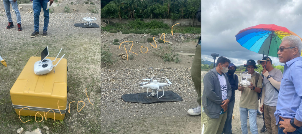
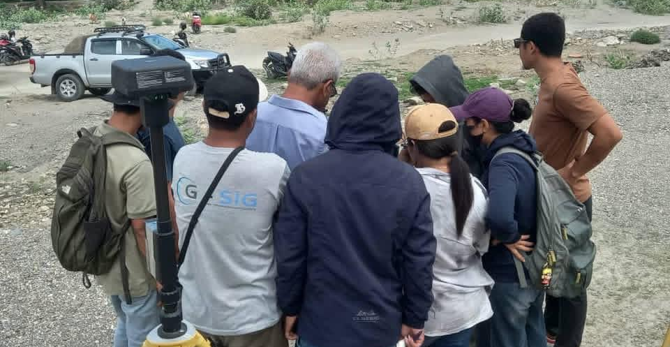
Earlier this year, G-SIG is proud to highlight the participation of our Co-Founder, Evaristo Benevides, who took part in an intensive Remote Sensing Drone Practice as part of his Master’s degree in Engineering at the National University of East Timor (UNTL). This hands-on training focused on advanced drone mapping techniques, equipping participants with the skills to capture high-precision spatial data using cutting-edge technology.

The practice emphasized two key methods: RTK (Real Time Kinematics) and GCPs (Ground Control Points). RTK allows drones to achieve centimeter-level positioning accuracy in real time, while GCPs enhance the overall geometric integrity of the mapping model. By combining these techniques, Evaristo and his peers were able to produce reliable, high-resolution photogrammetric data suitable for applications in engineering, construction, and environmental management.
Reflecting on his experience, Evaristo said: “Participating in this field practice was an incredible opportunity. Using RTK and GCP methods in real-world mapping helped me understand how technology and precision come together to create accurate, actionable data. It’s exciting to see how this knowledge can directly support projects in infrastructure and environmental planning.”
The training was facilitated by Prof. Benjamin Hopffer Martins, an expert in Remote Sensing and GIS, who guided them through both theoretical concepts and practical fieldwork. Evaristo added “Working under Prof. Martins’ guidance allowed me to apply what I’ve learned in the classroom to the field. Drone mapping is not just about flying a drone, it’s about understanding the landscape, planning each flight carefully, and ensuring every point collected is precise.”
At G-SIG, we are proud to see our team member continually advancing their expertise. Evaristo’s experience demonstrates our commitment to innovation in GIS mapping and geospatial solutions, showing how combining academic learning with practical application strengthens our capacity to deliver high-quality services. Drone-based mapping has become a key target for G-SIG in supporting Hazards Participatory Mapping and Disaster Preparedness in Timor-Leste.
Since early 2025, G-SIG has supported and partnered with Open Mapping Hub Asia-Pacific to integrate the Drone Tasking Manager into mapping activities for disaster preparedness and to support early warning systems based on real-time data in Timor-Leste.
Admin GISTL
0
Tags :